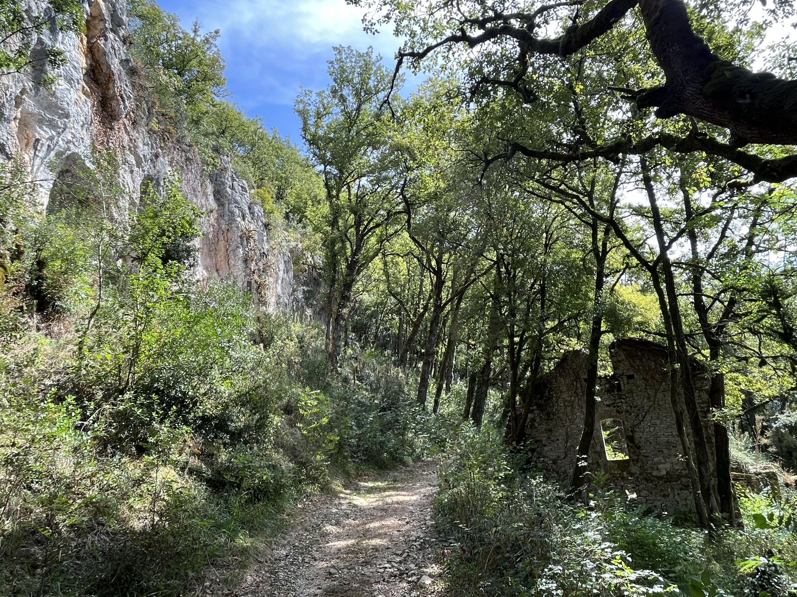
Camino Photo of the Day: the Cliffs of Insanity Starter Kit
The Camino ran through the forest alongside a river on my right for a bit, and occasionally there would be impressive stone outcroppings on my left. It was only when I reached a clearing that I could see the full extent of the landscape. The river (and the Camino) ran through the middle of a wide valley, surrounded on both sides by towering stone cliffs. Once back in the forest, none of this was visible.
Date: 03 September 2023
Place: between Labastide-Murat and Vers, Lot Département, Region of Occitanie, France
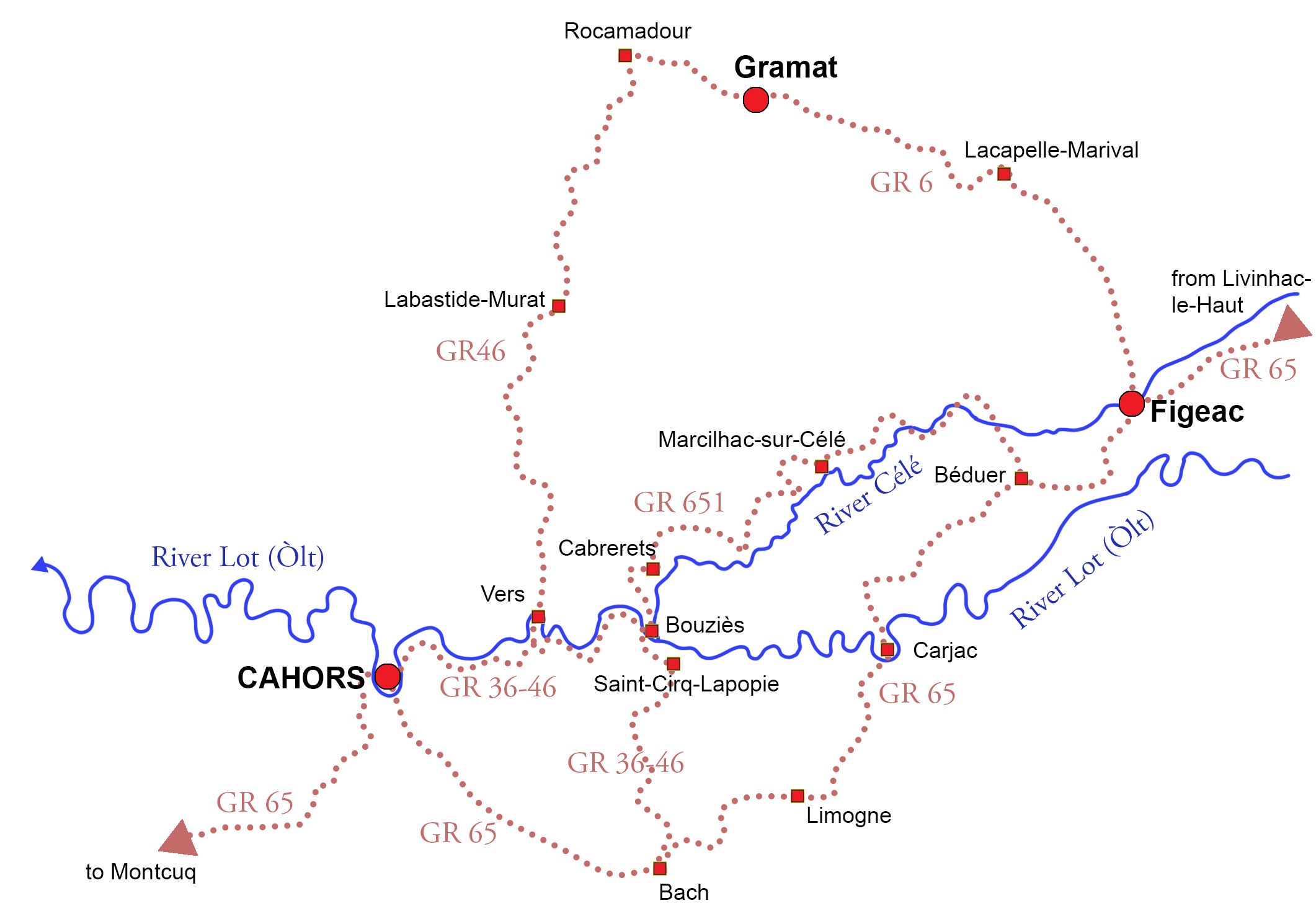
Maps!
The site I’ve been using for my daily maps, Gronze.com, while otherwise great, unfortunately doesn’t have maps for this variant. So here’s a map from my book Practical Pilgrimage showing the entirety of the three main variants and larger sub-variants. I walked the GR6 from Figeac to Rocamadour and the GR46 on to Cahors.