Camino Photo of the Day: the Road to Rocamadour
The Camino here goes through woods like this pretty much all the way. Those moss-covered stones on the right are what’s left of a wall possibly dating to medieval times. There would be more spectacular ruins as the morning progressed! The path begins in a relatively wide valley with a broad, if shallow, river to my left. Throughout the day, the valley narrowed until it became a canyon with steep stone sides.
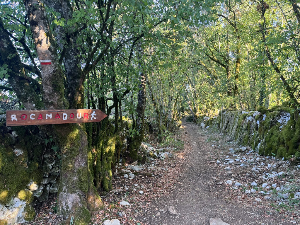
Date: 01 September 2023
Place: between Gramat and Rocamadour, Lot Département, Region of Occitanie, France
Maps!
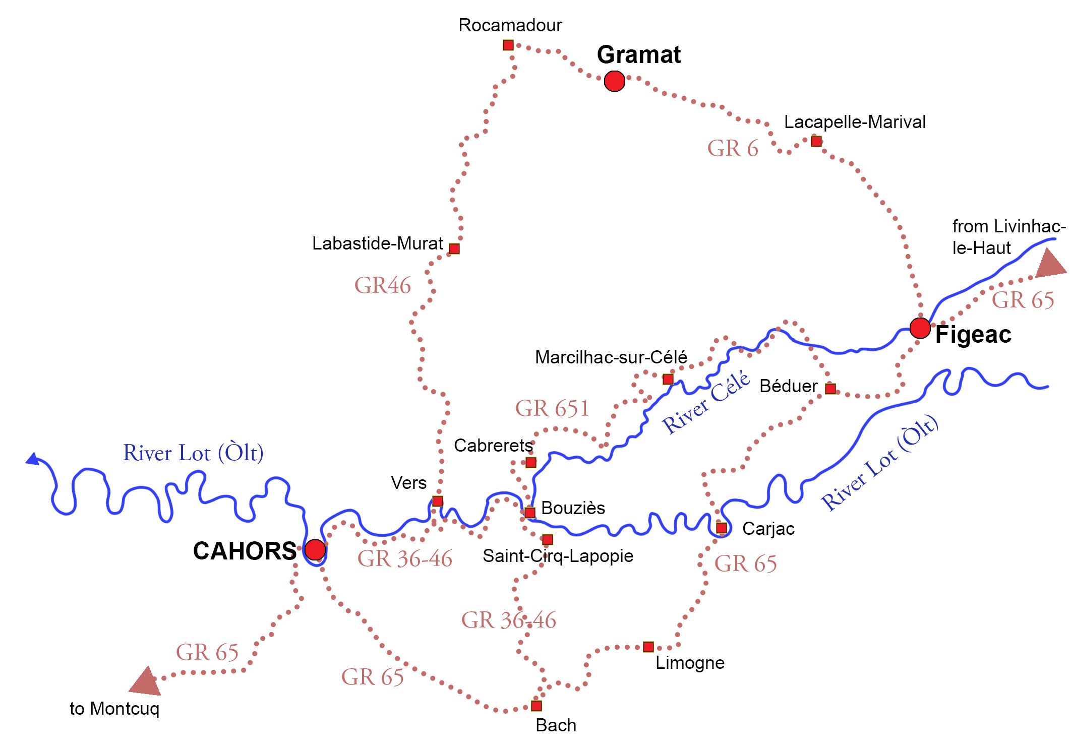
The site I’ve been using for my daily maps, Gronze.com, while otherwise great, unfortunately doesn’t have maps for this variant. So here’s a map from my book Practical Pilgrimage showing the entirety of the three main variants and larger sub-variants. I walked the GR6 from Figeac to Rocamadour and the GR46 on to Cahors.