Camino Photo of the Day: It’s a Map!
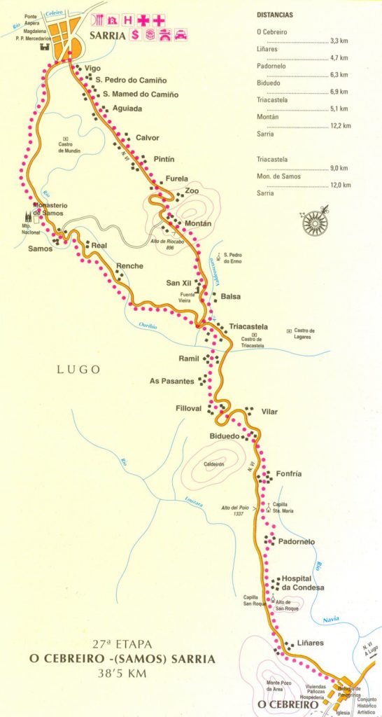
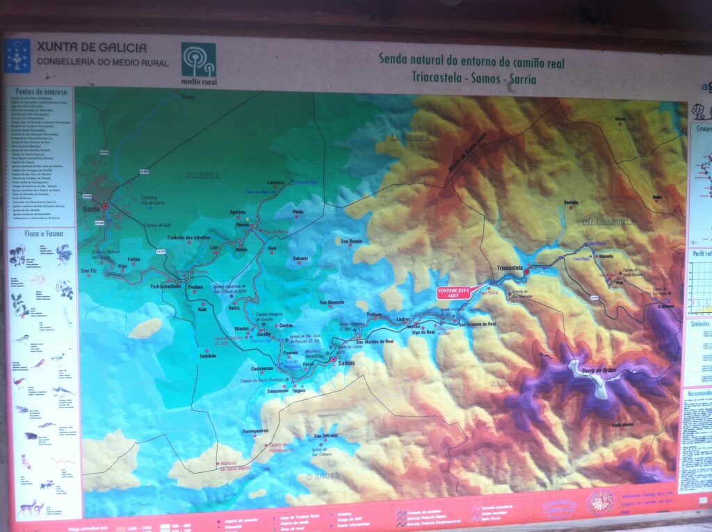
As you may be able to see from this roadside map sign, the Camino from Triacastela to Samos moves through a steep-sided valley, which might explain all of those cliffsides we are passing. The sign is at the spot where the Camino leaves the highway and strikes out through the forests, at least for a while.
Date: 26 April 2013
Place: between Triacastela and Samos (Province of Lugo, Galicia, Spain)
Today started: Fonfría (Province of Lugo, Galicia, Spain)