Camino Photo of the Day: Options
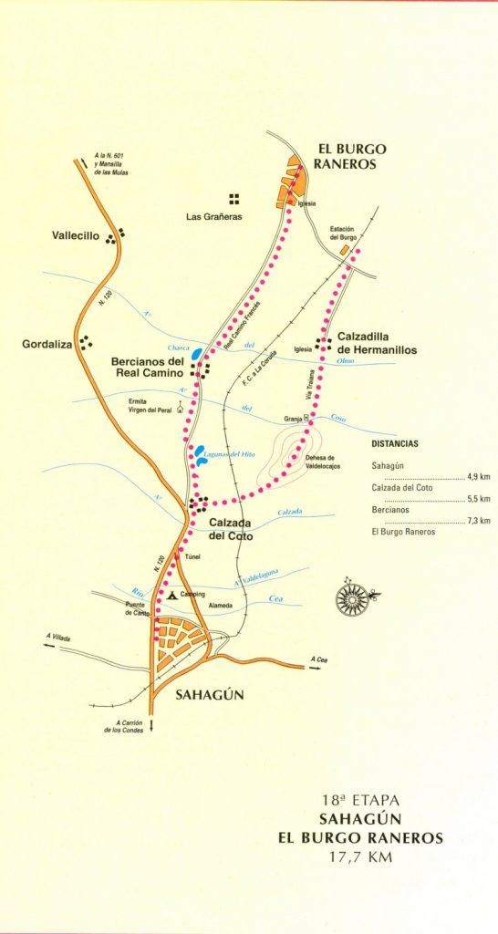
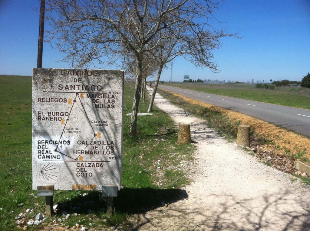
As you can see from the photo and the map below, the Camino offers two options at the village of Calzada del Coto. The two options don’t properly meet back up until Mansilla de las Mulas, some 32 kilometers down the road. It was already 1:30 when we passed this marker, so we which way we went had to be chosen with an eye towards how far we were likely to be able to walk and what was likely to be open. Could we make it as far as El Burgo Ranero? And if not, would Bercianos be far enough? Would it be safer to take the way towards Calzadilla de los Hermanillos, on the theory that it was a median distance? In the end, we took the left fork.
Date: 17 April 2013
Place: between Sahagún and Calzada del Coto (Province of León, Castilla y León, Spain)
Today started: Terradillos de los Templarios (Province of Palencia, Castilla y León, Spain)