Via Podiensis: All Roads Lead to Cahors
After a lovely breakfast with Tony the gîte owner and Constance the injured pilgrim from Brazil, I left about 7:40 into a cool, clear morning. Today was going to be hot, but it was also a short day – only 17 km or so into the great city of Cahors. My goal was to get to the city before noon.
In addition to beating the heat, I wanted to take advantage of being in a city to run some errands.
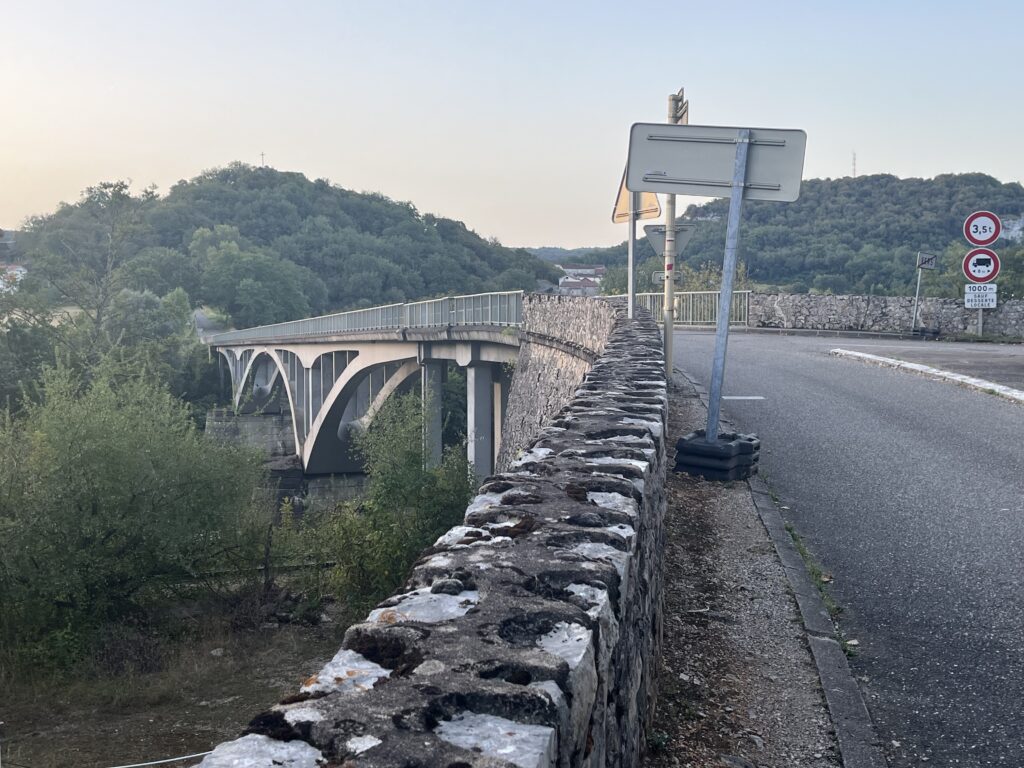
The Camino began practically at the front door of the gîte, which makes sense since it’s down the block from the church and right next to the Mairie (town hall), which are the two places in any given town that the Camino makes a point of going past. I left there by a long bridge over the Lot River.
I had left the Lot River Valley days ago in Figeac, and this far downstream the river has become very large, indeed.
After a bit of roadwalking, the Camino eventually meandered into a very rough forest path. The path climbed high above the river. From the vantage point near the top, I could see farms and gardens spreading out from the banks, so it appears that this rough route was designed to avoid the property of the farmers. I was already dripping with sweat, and the forest was warm and humid. The path soon leveled out, and it ran along a wooded ridge above the river far below, lost in the trees.
It was only when I came to a bit of a clearing that I realized that my path was at the same altitude as the tops of the cliffs that I had seen yesterday.
The approach into Cahors is confusing, because there are a myriad of alternate routes. I had to keep stopping at the intersections of various paths to consult my map about the best way forward. My goal was to avoid climbing every hill around the city and to get back to the river path as soon as possible.
Easier said than done.
Eventually the path descended, and I was roadwalking for a couple of kilometers. I was out of the forest, but still sheltered by the trees. The cool breeze that flowed through here was positively heavenly. Sometimes the cars speeding past were a little too close for comfort, though.
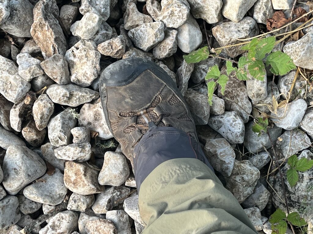
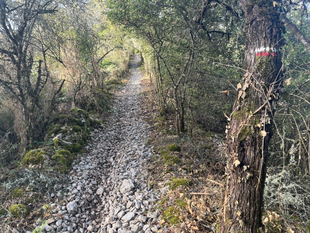
Eventually I returned to a rough stone path through trees. It was a slow, difficult slog uphill over stones mostly almost the size of my fist, irregular, slippery, and potentially ankle twisting. The thing that gets me about this, is that the stones were obviously placed here on purpose. The people who made the decision to use this kind of ground cover had apparently never tried to walk on it.
By the time I finally got to the top – to a roadway with a six way intersection no less – my feet were aching. I spent a couple of minutes just figuring out which direction I was supposed to go. It was already almost 9 o’clock, and I hadn’t even covered 5 km yet. of course, by the time I was finally walking down the correct path, I was over 5 km. The markings here were extremely confusing.
As the morning wore on, I became less and less sure that I was going in the correct direction. In fact, I was pretty solidly convinced that I was moving in a giant circle. My GPS app was telling me that the gravel road I was walking didn’t actually exist, but that I was making my way slowly back towards the river. I was still seeing markers on the trees every so often, so I was clearly on a path – I just had my doubts that it was the correct path. But I figured as long as I made it to the river, I could get to Cahors.
When the Way took a sharp left turn down a narrow, rock-filled forest path, I reflected on the fact that it would’ve been faster and easier to get to Cahors by simply walking the main road from Vers.
About this point, I passed a sign that indicated Cahors was 15.5 km away. If true, that meant that in almost two hours I had only gotten 2 km closer to the city. I was absolutely furious with myself, convinced that I had taken some scenic side track I hadn’t meant to. When the Camino eventually got to a road surface, I was basically powerwalking off my anger.
After a long walk through suburban sprawl and then ducking down a narrow ravine, I reached the river at 9:40 AM. The sign at the bottom of the ravine said it was another 13.3 km to Cahors.
It was exactly 2 hours since I left the gîte, and the distance to Cahors had only been reduced by 4 km.
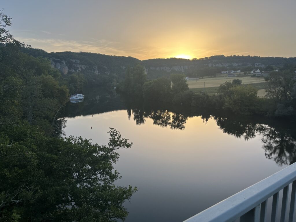
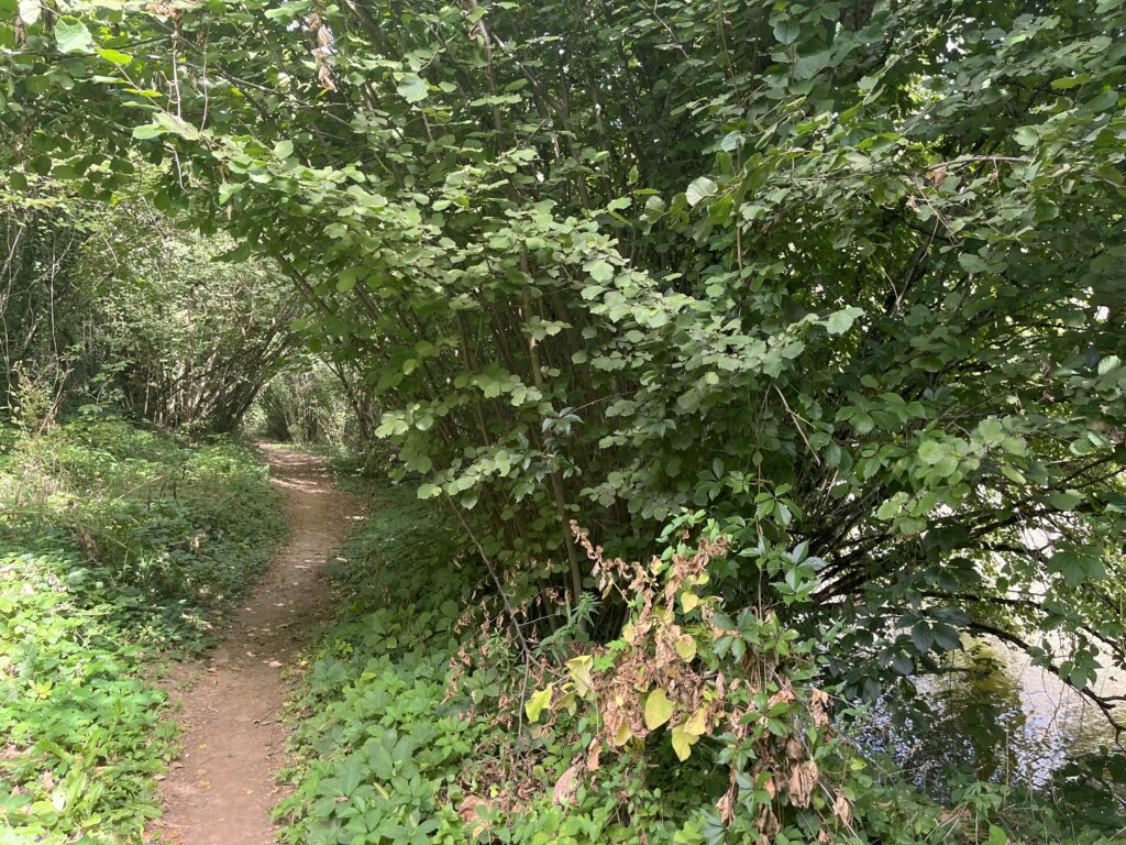
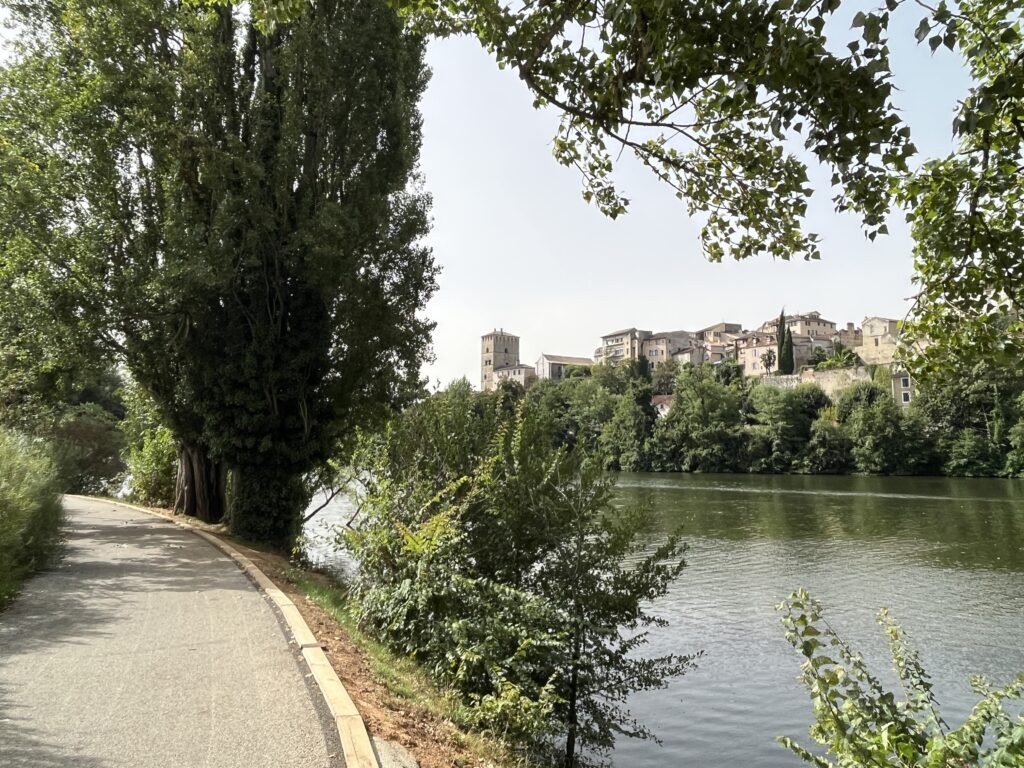
The river walk was pleasant enough, a small path just above the mighty River Lot, but I was in a foul mood. And so I walked, river with its wild growth of bushes and brambles to my right, farmland to my left, on a dirt track that would occasionally widen out to a road for short stretches.
Slowly, my mood lightened. I felt like I was actually making progress as I walked, instead of hiking over hills in big meandering loops.
When I caught sight of the river, I would sometimes see boats and wave to the crew and passengers. At one point a lady shouted “buen Camino” from the deck of her boat.
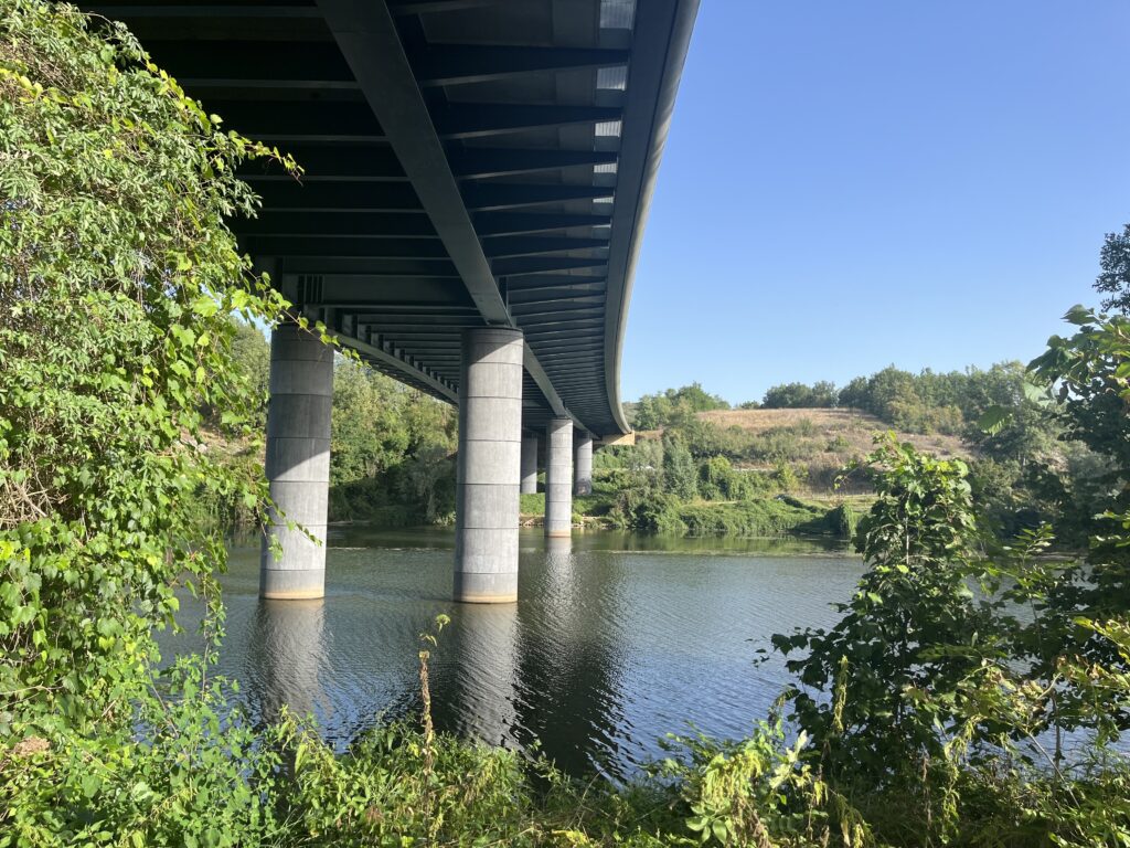
I passed under a highway bridge, and then by some boat locks, and suddenly the riverside path was a comfortable dirt path through trees. This reinvigorated me further, and I made pretty good time after that.
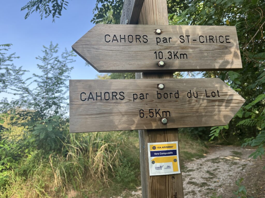
Finally, I came to the sign indicating two different ways to Cahors, one along the river that was 6.5 km, and one via Saint-Cirice that was 10.3 km. Apparently, the sign makers considered the direct route into Cahors to be a “variant”, so the various distance signs were all referencing the longer route. At this point, I stopped for a little break to have a celebratory cookie. It was about 10:30 AM.
Sometimes, you just need to have a cookie. Or two.
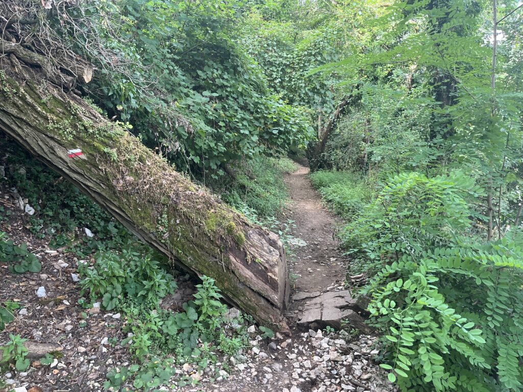
Parts of the trail after this were not particularly well-maintained (or marked), but it was beautiful throughout. One memorable moment included a downed tree across the path with no option but to scramble over and through it. In another place, the Camino had simply been cut through a fallen tree.
Occasionally I would pass little jetties on the river with canoes or rowboats tied up. I spotted the ruins of a tower across the river.
There was an unmarked turn that I totally would’ve missed, had a kindly woman out watering her garden not pointed me in the correct direction. After this, the path opened out and traversed a wider woodland between the river and the bluffs above. It was cool and breezy for the most part, but when I came to clearings the sun would blaze down upon me.
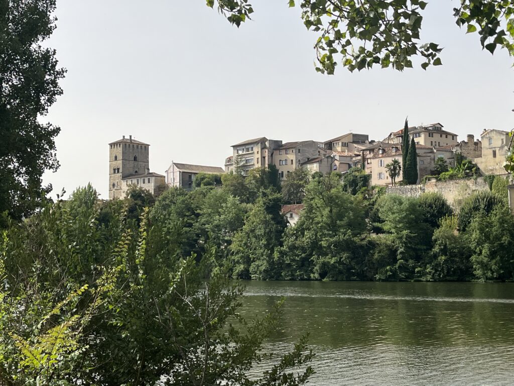
Finally, about 11:30, the path deviated uphill from the river, and I found myself roadwalking past farmsteads and row upon row of greenhouses. I could now see the towers of the city in the distance.
I was walking in the sun, and it was already 87°. The umbrella came out at last.
The farms soon transformed into suburbia, and within just a few minutes became very urban indeed. Even though I was walking on the sidewalk by this point, traffic would slow down as they passed me. I presume they were trying to get a better look at my crazy umbrella.
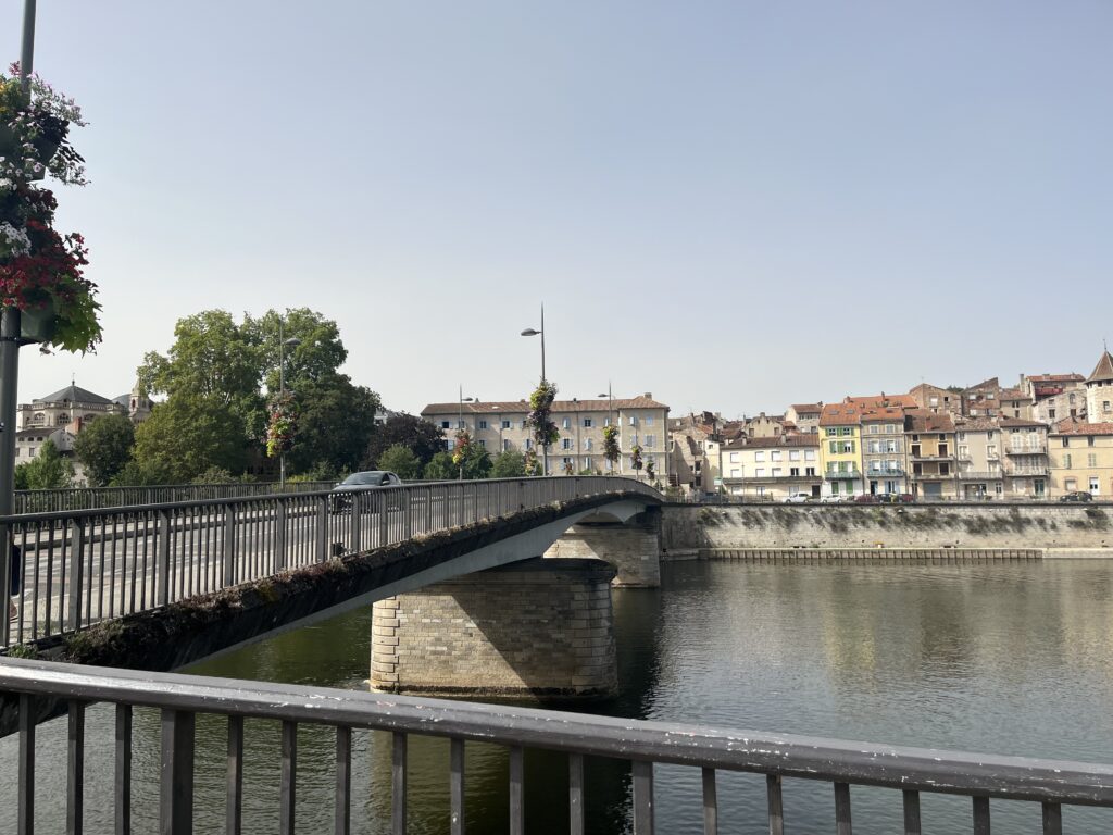
The medieval city of Cahors is surrounded on three sides by the River Lot. The Camino took me on a pleasant park-like promenade next to the river to the bridge.
As I crossed this very modern bridge into the medieval city of Cahors, the church bells were ringing out the hour of noon.
More about the rest of my day in Cahors in the next post!
Date: 04 September 2023
Place: Cahors
Today started: Vers
Today’s Photos!